Acoustic techniques that are used to efficiently study a large area and the interpretation of the data can be very complex; however, the day-to-day decision-making of a scientist is often very simple.
The beauty of the DISCLOSE project is the multidisciplinary approach. The North Sea should be studied on different scales to understand the distribution of benthic fauna. And that’s exactly what we’re doing. We took box cores of 0.07 m2 resulting in a total studied area of about 4.9 m2. We filmed a total area of about 1350 m2. Finally, we tried to map the total area of 50 km2.
If you want to efficiently map a large area, acoustic mapping is the way to go. Basically, these maps are plots of the properties of reflected sound waves. Therefore, you only have direct information about the return speed and intensity of the wave reflection. Proper interpretation of these variables can result in information about the habitat. This is very useful for us, as one of the goals of DISCLOSE is to create comprehensive habitat maps of the North Sea.
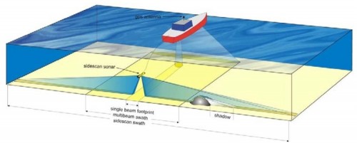
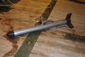
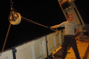
During this cruise we used the multi-beam echo-sounder and side scan sonar (Figure 1). Both systems are based on the concept of sending out sound waves, which are reflected by the seafloor. The time between outgoing and returning waves is measured to calculate water depth. The change in wave intensity is measured to identify the material which reflected the waves. The multi-beam is fixed underneath the RV Pelagia and could be used at night without supervision. In contrast, the side-scan sonar (Figure 2) needs to be deployed into the water column and must be kept at a constant height (~10 meters) above the seafloor. Therefore, the cable length was constantly adjusted to deal with the irregular seafloor. It meant hard work for Leo, Afrizal and Patrick, who manually controlled the side scan sonar cable (Figure 3).
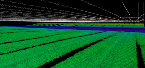
One of the products that comes from all the data that was collected is the 3D landscape map of the Bruine Bank that is seen in Figure 4. It is true that in order to produce this image an amazing amount of data, coming from very sophisticated sensors, needed to be crunched. Doesn’t this just sound like the epitome of a scientist? Expensive and sophisticated equipment like, global positioning systems, multibeam echosounders, and motion reference units, all sending out reams of data that is perfectly synchronized so that it can then be interpreted by a computer software and projected as a 3D map on a computer screen. While all of this complexity is certainly present, the actual collecting of scientific data at sea is a simple exercise in preparation and coordination.
Prior to the cruise the exact research area is defined. This process is as much influenced by practically avoiding busy shipping lanes, as it is by looking for interesting seabed features to map. The decision if the survey lines will be oriented north south or east west (or some other direction) is based on the wind and current directions and the fact that it is easier to keep the ship on course when the wind comes directly from the front or the back of the ship than when it comes from the side. Then one takes into consideration such things as, how many days do we have at the survey area, how fast will the vessel travel during survey operations, and then a simple multiplication of speed and time gives the total number of survey lines that can be performed.
When the moment arrives to prepare for the survey, rather ordinary things, like ensuring all the cables are securely and correctly connected to the side scan sonar and checking that all the recording computers are turned on, take center stage. When all the equipment is set up then the scientist, the “officer of the watch” (a seaman’s term for the ship’s driver), and the deck crew meet up to discuss the plans for the night. In this final preparation, the things that are talked about are, which lines will be surveyed tonight? In what order will the lines be surveyed? Will the deck crew take the side scan sonar out of the water during a turn at the end of a line or not? Or, at what time of the night will the wind direction change, and will this affect the sailing direction during the survey.
So you see that, on the one hand, to be a scientist might require the understanding of complex things like the physics of sound spreading in water, or how to use the data from a motion reference unit to know in what direction a sound signal got sent into the water column. But on the other hand, the art of collecting scientific data can be uncomplicated, and directed by the most practical, and almost mundane things. Things like, will the wind blow the ship off course if we run a survey line due west? Who would have known the life of the scientist would be so multi-faceted?


